

Hiking trail general characteristics
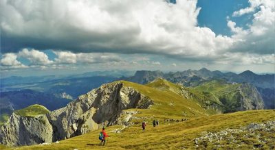
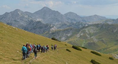
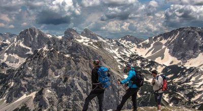
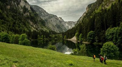
The hiking trail Stabna – Stabanski katun – Mramorje – Kručica is a part of the hiking trail which leads from Kručica Mountain to the peak called Veliki Vitao (2,397 meters above sea level). From Kručica you can get on a hiking trail that leads to the village Stabna through the Stabna Lakes, and thus return to the starting point in this village. The hiking trail Stabna – Kručica, 5.50 km long and relative altitude of 720 meters, belonges to an easier category of hiking trails. The trail can be crossed in about 2h and 20 minutes in one direction , and in return, depending on the direction of return – in about 1h and 40 to 1h and 50 minutes. According to the characteristics of the hiking trail, it requires a medium hiking condition and it is recommended for the hikers beginners. The starting point of the trail is at crossroads 80 meters north of the church, then further on, the trail leads along a narrow asphalt road to the upper part of the village Stabna and at 1.1 km there is a turning to the local dirt road in the direction of the forested steep side. Further on, in the zigzag shape, the trail leads through the beech forest on the steep side until it reaches the pasture of the very picturesque Stabna katun (livestock pasture). After that, the trail leads northwest through the bare sides covered with pastures all the way to Mramorje (the old cemetery). From Mramorje, this trail turns northwest towards the natural ravine to the spring called Zemunica, located on Kručica Mountain slope. From Kručica it continues along the marked trail to the peak called Veliki Vitao in the north direction, and in the west direction it descends down the slopes by a marked trail towards Big Stabna Lake and further on to the village Stabna.